


Renhill Voting District, King County, Washington
About
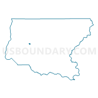
Outline

Summary
| Unique Area Identifier | 684818 |
| Name | Renhill Voting District |
| County | King County |
| State | Washington |
| Area (square miles) | 0.55 |
| Land Area (square miles) | 0.55 |
| Water Area (square miles) | 0.00 |
| % of Land Area | 100.00 |
| % of Water Area | 0.00 |
| Latitude of the Internal Point | 47.49425420 |
| Longtitude of the Internal Point | -122.13042810 |
Maps


Graphs
Select a template below for downloading or customizing gragh for Renhill Voting District, King County, Washington


Neighbors
Neighoring Voting District (by Name) Neighboring Voting District on the Map
- Brigid Voting District, King County, WA
- May Valley Voting District, King County, WA
- RNT 41-2583 Voting District, King County, WA
- RNT 41-3287 Voting District, King County, WA
- RNT 41-3404 Voting District, King County, WA
- Sunset Voting District, King County, WA
- Tanner Voting District, King County, WA
Top 10 Neighboring County Subdivision (by Population) Neighboring County Subdivision on the Map
Top 10 Neighboring Place (by Population) Neighboring Place on the Map
Top 10 Neighboring Unified School District (by Population) Neighboring Unified School District on the Map
Top 10 Neighboring State Legislative District Lower Chamber (by Population) Neighboring State Legislative District Lower Chamber on the Map
Top 10 Neighboring State Legislative District Upper Chamber (by Population) Neighboring State Legislative District Upper Chamber on the Map
Top 10 Neighboring 111th Congressional District (by Population) Neighboring 111th Congressional District on the Map
Top 10 Neighboring Census Tract (by Population) Neighboring Census Tract on the Map
- Census Tract 251.02, King County, WA (7,456)
- Census Tract 319.03, King County, WA (6,411)
- Census Tract 256.02, King County, WA (5,474)